-

Aviatrix errors “network is unreachable for dns resolution”
This just took me a little longer to figure out than I’d like to admit. TL;DR: Stick this in your hosts file: Workings Out Every time I tried to start Aviatrix I’d get this error: So, I tried stracing it to see what’s up. Run the strace, search the output for the error string and…
-
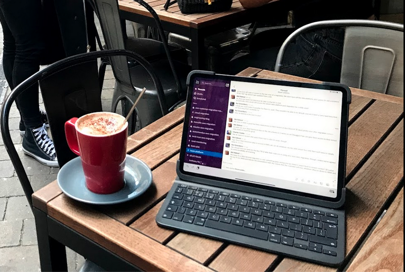
Better Slacking
When I started working here we were around 50 employees in two countries, and now we’re going past 300 in four. I think we’ve outgrown our organically-evolved Slack usage and we’ve slowly bumped into a few problems, or at least things that aren’t as good as they could be. There’s a few people who agree…
-

Parsing JSON fields in AWS Log Insights
This just took me too long to figure out to not write down somewhere! Say you have a log of the form: My reading of the log insights docs made me think this ought to work: Because you’re wanting to parse the message field out of the JSON. But it won’t, because rather than interpreting…
-

Adding a (scientifically-useful?) workload to k3s
I’ve got a k8s cluster in my cupboard, and the plan here is to work on some debugging and monitoring posts and tools, so I need a workload. The first workload will be folding@home, because it’s easy :) And in a break from helming, I’m going to apply the manifest here. We have a couple…
-
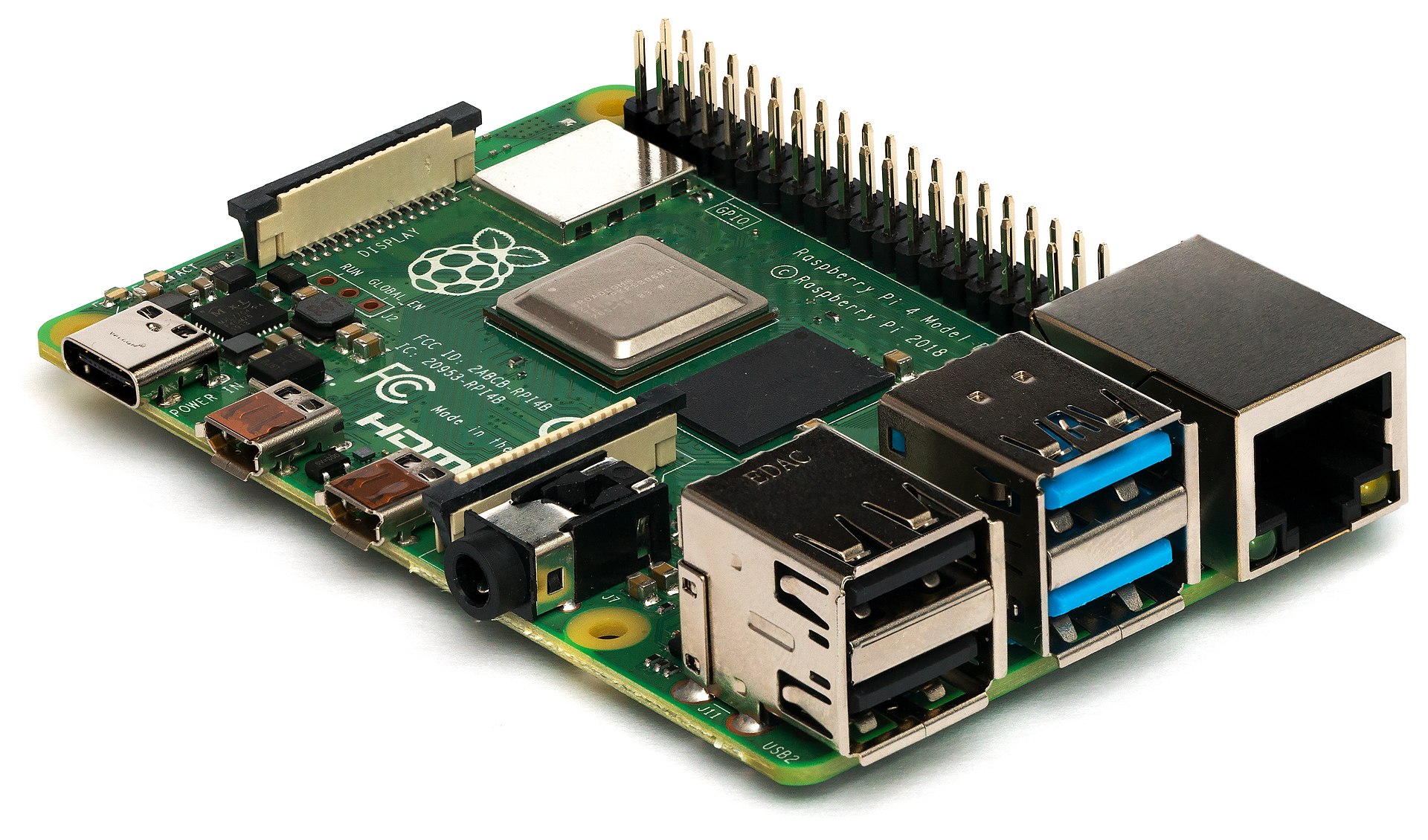
Fixing MacBook Wifi with a Raspberry Pi
I have an M1 Macbook Pro and a thunderbolt dock, and I am suffering what seems to be a reasonably normal experience of often-poor net connections: https://apple.stackexchange.com/questions/441705/m1-macbook-pro-drops-wifi-periodically My dock (a CalDigit) doesn’t have its own WiFi chipset (quite reasonably – what am I going to plug into it that doesn’t have its own?) but it…
-
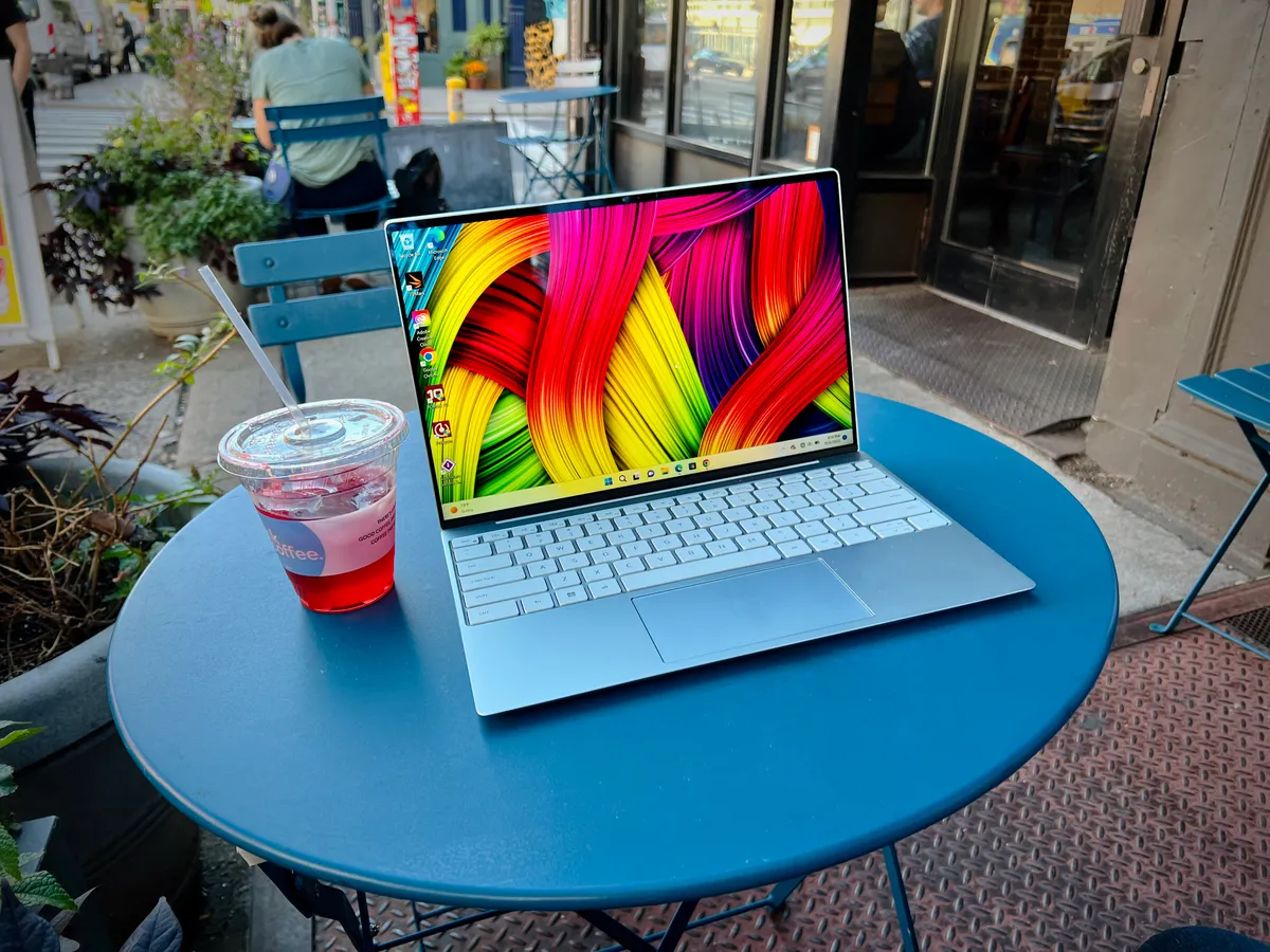
Modern laptops are quite good, actually
There’s some talk in the bits of the Internet I hang out in around how poor modern laptops are. As expected (given the bits of the Internet I frequent) a lot of this boils down to the way modern laptops are not Thinkpads. The most recent thing I read was An Epitaph To Laptops and,…
-

Grafana on k3s (with metallb and nginx)
This is a follow-on from my earlier post, but hopefully k8s is consistent enough that you don’t need to know that. Sadly, this is less helmy :( Use the Prometheus-operator We’ll use the prometheus operator to install and configure prometheus. First, let’s get everything created. This will clone a git repo then create a bunch…
-
K3S with metallb and nginx-ingress
I followed Greg Jeanmart’s tutorial for this a few years back, but things have changed, as they always do in k8s! I’m also lazy and like to steer close to Helm installing stuff. This is all on a Debian machine who’s hostname is nuc Install K3s First, install k3s, without servicelb (we will use metallb)…
-

Learning MacOS
I’ve just taken a job where I get a Macbook, and here I’m going to keep track of some problems I hit and what their solutions are. Some have no solutions yet – I’m keen to hear them if you know them! This is not a flamey list of things that are awful about MacOS…
-
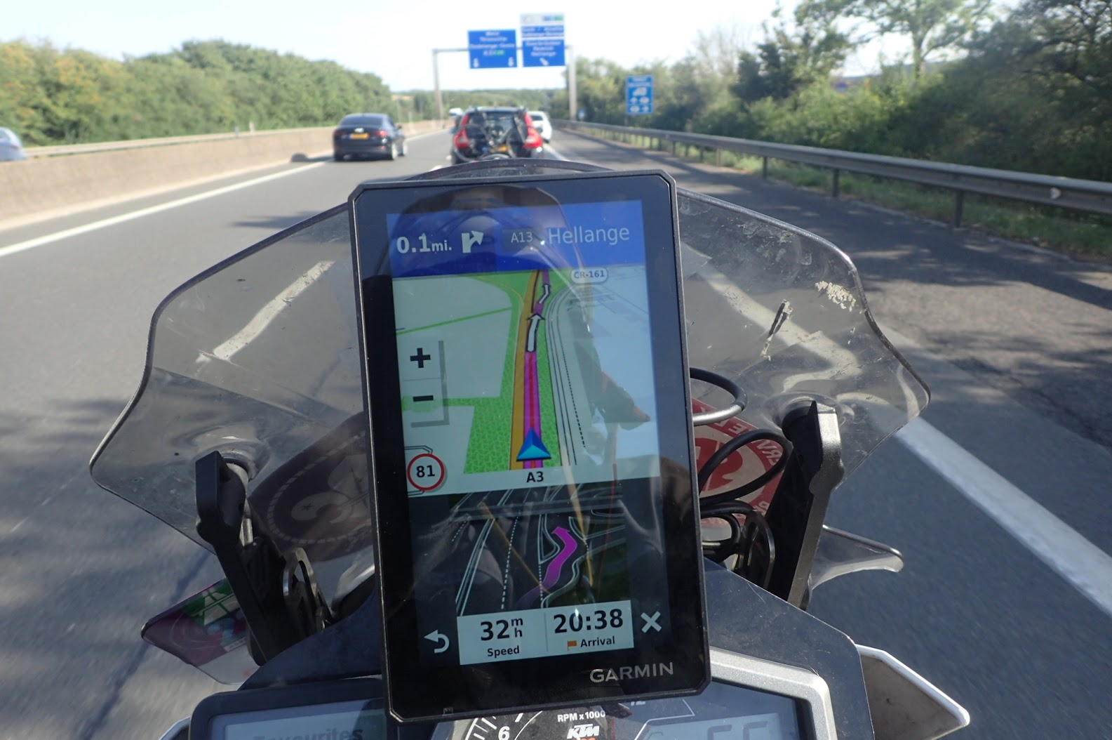
The Zumo XT is much better than the 346
I’ve bought another Garmin :) In planning our trip to World Ducati Week it became clear I’d be navigating, and the weather would be unpredictable. I’ve found that whenever I have a problem with a phone navigation it’s my fault, but if the Garmin goes wrong then that’s expected, so I decided to at least…
-

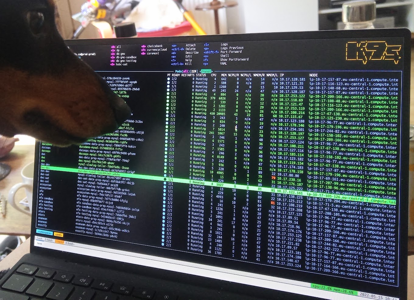
kubectl port-forward and the lost art of bash job control
A really common part of debugging stuff in k8s is to create a port-forward and then open a new shell and do a thing. Which is fine and easy when you’re port-forwarding to the machine you’re actually sat at, but less so when you’re not.
-

Good Meetings
I’m holding a lot of meetings at the moment, for a bunch of different reasons, and with different people. I’ve settled on some principles that I think are pretty universally true: All meetings are optional If someone doesn’t want to be in a meeting then they probably won’t gain anything from being there, and nor…
-

Perl Language server in VS Code
Thanks to Grinnz via haxmeister: Do cpan PLS and then install this plugin:
-
Fortnine videos
Fortnine has another video: And this is a great demonstration of the standard form of a Fortnine video. They are not a discussion of the various views and theories on a topic, they are his view, backed up by some points he’s found that support it. This one, too, skips a bunch of stuff to…
-

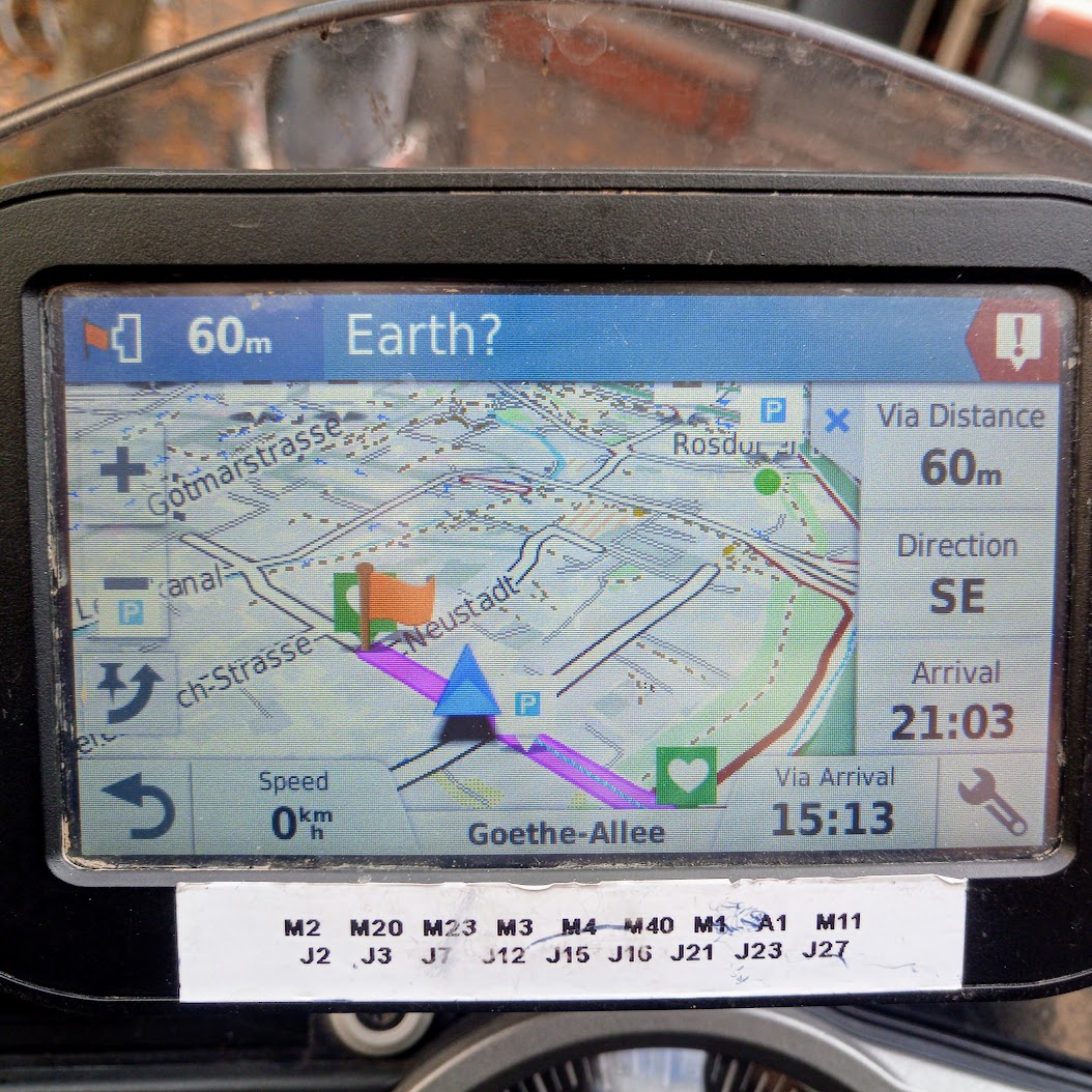
Satnav Features
There’s a number of features of a satnav that seem really obvious, yet many or most don’t have them. This is another conversation I keep having, so here’s my list. If you’re building a satnav, please steal these ideas!
-

Documentation
Documentation is a last resort. Few people want to read a document, and fewer still want to write it. I think the appropriate attitude towards documentation is to have as little of it as possible. First, try to not write documentation In an ideal world, we don’t need any documentation because everyone already knows everything.…
-

Podcasts
I keep talking to people about podcasts, so here’s my list of the ones I’ve probably recommended at you: Ones I listen to regularly Do The Right thing – Comedy panel show where guests have to figure out the right way to respond to given situations. More comedy than panel show. Something Rhymes With Purple…
-
Garmin Zumo 346 “Review”
I’ve spent a long time using various Android phones and apps to navigate on a motorbike, and mostly been unimpressed with dedicated satnavs. I’ve written a not-unbiased comparison of dedicated units with phones and generally while I’m not completely satisfied with the app offerings, they do seem better than using a dedicated unit. I did,…