I’ve spent a long time using various Android phones and apps to navigate on a motorbike, and mostly been unimpressed with dedicated satnavs. I’ve written a not-unbiased comparison of dedicated units with phones and generally while I’m not completely satisfied with the app offerings, they do seem better than using a dedicated unit.
I did, though, find myself with a surprise £350 and thought I’d figure out what the fuss is about; I bought a Garmin 346 LM in September 2018 (shortly after its release) and here I’ve noted down my first impression, my opinion after using it for its first week-long trip, and again about ten months later. I’ve been editing this ‘backwards’ so that the most-recent opinion is at the top.
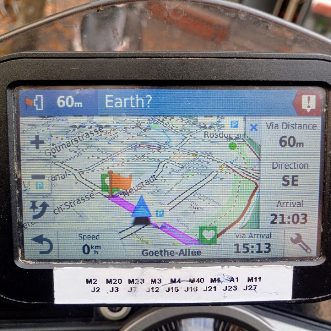
(A few years later, I’ve bought the newer XT and written some notes)
In conclusion
It’s now September 2020 I’ve been using this for a couple of years during which there’s been many one-day rides, fewer extended trips, a bunch of trail riding, an awful lot of routine “take me to this postcode”, 3 months going to and around Poland, and I think I’ve formed a proper opinion.
It’s in a box on a shelf and hasn’t come out for a few months. I don’t benefit from using it over my phone.
The good
Contrary to my initial assumptions, there’s some things it does well
- The mounting bracket is very good – one-handed fitting or removal of the unit, and it’s obviously always automatically charging. It comes with a complete RAM mount.
- As promised, the screen does not go bonkers in the rain; combined with the powered mount you don’t need to think about the rain at all.
- It can be set to always track your route, so if the device is on you don’t need to think about whether to start tracking or not.
The not-so-good

There’s also a few things that are good ideas that just feel a bit unfinished; it’s not-as-good as the competition but does still function:
- Perhaps most surprisingly, it’s bad at showing maps. It takes a long time to render maps (such as when scrolling or zooming), the image quality of the mapping is poor (presumably a function of the low screen res) and the density of information makes it hard to recognise which area is being looked at. The Talky Toaster maps resolve the last of this, but at the expense of proper routing – you cannot show one set of maps while navigating with another. Here’s a video showing how long it takes to plot a 50mi route: https://www.youtube.com/watch?v=M2ou4yAVZn0
- There is a Garmin phone app which allows you to send points to the device from your phone, so you can find a POI in your satnav of choice, or using Google maps, and ‘share’ it to the Garmin. The process is clunky and only mostly-reliable. It does work, but it feels more 2004 than 2019. It also requires the phone have a mobile data connection for some reason. An update to the unit allowed for the sending of GPX files over bluetooth.
- The search is still leftover from the ’90s. The norm for satnav apps is to have a search box into which you can enter a postcode, or an address, or the name of a business and it’ll just find it. The garmin has no such thing, and you instead need to navigate to the “postcode” box, or differently to the “City” one to enter a whole address, or open “Foursquare” to search by business. There is something that looks like it will just search everything, but I’ve never managed to use it to find where I’m going and I’m still not sure what it’s actually supposed to be for.
- It’s not clear what the difference is between searching ‘Foursquare’ or ‘Tripadvisor’, but many things are in both, and many things are also only in one or the other. Quite a lot of POIs are in neither; mostly I transcribe postcodes from my phone.
- Garmin’s way of routing using specific roads is using a “shaping point”. When you’re in the mode for adding these to a route you can’t zoom in as far as you can in other modes, which is frustrating when what you want to do is put a point at a specific part of the map. There’s also no confirmation when you add a point – it immediately starts calculating the route – which is frustrating with the mix of poor zoom level, poor screen quality and fat fingers.
- There’s a relatively-useful fuel tracker, where you set a tank range and it can warn you when you’re at only 10% or 15% or whatever of fuel-range left. When this is on, though, every time you start the bike you get a full-screen warning telling you that it is strictly only for bike use and not car use, which you have to tap on to close. The only way to see the currently-remaining fuel range is to add it to the navigation screen, but in that case it’s only populated when the device has a satellite fix, so you cannot consult it while indoors at a cafe planning the next leg of the trip.
- One of my favourite functions of CoPilot is the ‘On Route Alerts’ which means you can have an icon display on the app when there’s a POI in one or more of your chosen categories within 50 miles, and you can tap on it to route to it. I set that to show petrol stations and if that’s not displaying by the time my fuel range countdown reckons I’ve ~75 miles left I’ll pull over and find a petrol station. I was expecting Garmin’s “Up Ahead” feature to be this, but it isn’t: it cannot be set to only display things on-route so there is no way to use it passively – you always need to tap through the menu to find out where the thing is. It also can’t be set to show only petrol stations, you must set three categories.
- It doesn’t automatically-adjust the screen brightness, which I probably only find surprising because most phones can do that and it seems weird to need to find the brightness setting manually these days.
The Bad

- There’s some sort of Garmin-specific GPX or something. I don’t know the details, but GPXes that are produced by things other than Basecamp and work in other navigators frequently go a bit wrong. You won’t know this when you load the route, but at some point during the day it’ll become a line of flags.
- It can’t be set to work in portrait mode, only landscape, which is odd on a device whose main purpose is to show what’s coming up.
- The maps are out of date – there’s a series of junction changes in Central London that predate this device existing by several years, and are not represented on the latest maps. The device is best ignored when navigating around London (and presumably other large cities?) and I don’t know what to recommend to people who don’t know their way round there.
- When you plug in the USB cable, the device will count down 20 seconds before presenting itself to the PC. There is no way to skip this.
- Converting from a GPX track to Garmin’s internal idea of a route can take between 30 and 60 seconds for a 100mi route with four or five waypoints, during which the device can turn itself off because it thinks it’s not being used unless you tap on the screen to keep it awake.
First Trip

(October 2018) I went round a bit of the TET and used the Garmin as my main navigation tool for it. The idea was to just follow the GPX downloaded from www.transeurotrail.org and follow it, occasionally routing off it to find things like petrol stations.
The Garmin is very good at drawing a line on a map, which is all it can reasonably do with a GPX that involves trails; even with the Talky Toaster OSM maps it was very unreliable at turn-by-turn on the trail. I wasn’t comparing directly (and I’ve never ridden those trails before) but it felt much less useful than Locus Maps’ off-road navigation.
While the Garmin Connect app lets you send locations to the satnav, you can’t send routes (this was added in a later update to the device). The only reasonable way to plan routes mid-trip is to use a USB OTG cable and/or micro-sd card reader. The unreasonable-but-expected way is to just carry a laptop with you. Basecamp also needs a mouse, since you need the scroll wheel to zoom.
I tried using the tools I’m used to (Viewranger and Locus Maps on Android) to create GPXes and send them to the Garmin to create on-road routes but it always complained that there were too many “waypoints” and offered to convert them to “shaping points”. I don’t know what the difference is, but often I seemed to get the right sort of routes, though I don’t know how reliable this is.
So, generally, I stuck to having it just draw the GPX route and follow it by keeping an eye on the screen, which is fine at dirt-bike speeds. I did try to use it to find things to use (petrol stations, cafes, etc.) and it seemed strangely bad at this – it was always faster and easier to use my phone and either transcribe the postcode – so I think I must have missed something, and will read the manual when I’m back.
I think that most of the obvious failings of the device – that you can’t really use it for viewing maps because the screen resolution is so poor – is probably explainable as a result of it needing to be a resistive touch screen, and those having a poor resolution. I’ve not really researched it but I want to believe there’s good reason my £350 navigation device is so bad at navigation.
I can now see myself using this for trail riding and off-road biased trips where I can create a GPX route and send it to the device and have it drawn on the map. I haven’t yet worked out how I’d make it work on an extended road-riding trip where I’ll need something less prone to reinterpretation than a GPX route, but I haven’t yet looked.
Second Impressions
(September 2018) I’ve resolved to try to not have fully decided how good an idea this was until at least post-Christmas, but from a first week-and-weekend’s riding (some commuting, two blood runs and a day’s errand-running) this is better than my phone at:
- Plugging in one-handed
- Not worrying about charging
- Always being a satnav and never pulling out of a cafe with Instagram still open
And worse because it:
- Keeps sending me to petrol stations that haven’t existed for five years
- Takes ages to figure out where it is
- Takes a long time to recalculate routes (it’s always quicker to just muddle back onto it)
- Is impractical to use to plan/plot a route
- Has a really poor trip-overview display
I expect some of this this will get better and the rest just more-acceptable with time, but I’ve really not had the “why didn’t I do this sooner” thing that I keep hearing about other people doing.
The “Favourites” feature is very crude and unconfigurable but the Garmin Connect app installs itself as a mapping thing, so when you “open” a location on the phone (from a calendar event, say) you can send it to the satnav. I suspect that I’ll carry on using my phone for storing locations and whatnot, and just send them to the satnav as I’m used to sending it to a satnav app.
I think it’s worth having, but I can’t see myself becoming one of those people who advises other people buy one. This is definitely lacking in almost every way compared to CoPilot and friends, and I’m not (yet) convinced that that’s just familiarity.
First Impressions
It’s 20th September and it’s arrived!

Out of the box, first impressions are not great; they’re still using the USB socket that’s so old that I know it as “the one GoPro still use”, and I don’t even have a GoPro (or any of those cables):

The bracketry is all easy to fit and the lead’s surprisingly long and thin; the 12v/5v step-down box is partly along the wire so it’s easy to have that hidden away under the plastics.
I immediately tried to set it to portrait mode but can’t find that in the menu, might have to actually read the manual!
Buying a dedicated satnav
I misunderstood a bonus scheme and have £350 that I didn’t expect to have. I intend to use this to figure out what I’ve been missing all these years by avoiding dedicated satnavs.
The two brands that make bike satnavs are TomTom and Garmin. TomTom’s cannot be loaded up with a GPX file that goes off-road so I can’t go with one of them, even though they look more polished. Garmin it is!
There’s three Garmin lines – the Zumos are their road bike devices, have the widest selection of features and are the most-modern; the Montana is specifically aimed at off-road riding; and the Monterra is actually an Android device and so may solve all my problems.
The Monterra is an Android 4 device (Android 5 came out in 2014; 4 years ago at time of writing; 8 is current) so even if the apps I like now do work on it, it’s likely they will stop at some point in the future. This was clearly Garmin’s experiment with Android, and they’ve sadly decided to not keep it up.
The Montana is the one everyone recommends, because it’s got an ‘off road’ mode and an ‘on road’ one. The off-road mode doesn’t appear to add anything the Zumo’s don’t do; it’s not any more aware of rights of way than the road-mode one and is still largely used to display GPX routes. The on-road mode is much more primitive than that found on the Zumos. It looks like the OS maps for the Montanas can be loaded onto the Zumos.
The Zumo can be loaded up with an off-road map (courtesy of TalkyToaster, who is recommended for the Montanas over Garmin’s mapping anyway) and can have a GPX file displayed over the top. While you can trivially switch between off-road and on-road on the Montana, it seems you can do similar on the Zumo just by changing the display mode for the map. It’s also got the much-better road mode, and the modern ones have some sort of smartphone syncing.
I’m going to get a modern Garmin.