France has some wonderful scenery but an awful lot of French people. Belgians are much happier to speak English, but have very straight roads and not many hills. Ireland, apparently, has some fantastic scenery and is full of people who speak a pretty recognisable form of English. And they use holiday money, too!
So, I planned a trip to Ireland. Right at the bottom of this post is some handy notes if you’re thinking of doing the same.
After most of the people initially coming along either got jobs or lost jobs and so pulled out, three of us made it to the pre-ferry meeting point at a cafe in Pembroke, but only two of us made it as far as the ferry:

And one of us had developed a crude form of active suspension:

Having got off the ferry in the early evening we headed for Cashel for the night. The next morning we wandered into town to plan our riding for the day, and stumbled across a ride-out.


We were invited on it, but then they left early (!) so we ended up chasing them and meeting at their half-way point. We rode back to Cashel with them, though, and arrived at about lunch time. We weren’t due in Cork until that evening and Tipperary was not actually a long way away, so we decided to go through it on the way. It’s not an especially pleasant town, but no Raries were being tipped.
Cork hostel was a little cosy for the bikes, perhaps, and being asked “you did lock them up, didn’t you?” wasn’t the most confidence-inspiring greeting, but being a proper town offered some time to faff about getting some fork oil, filling a topbox with lunches, and being bemused by the way the Irish advertise their crisps


The full extent of the planning I’d done in the UK was as far as staying in the An Oige hostel in Black Valley on Sunday night, and then riding the ring of Kerry on the Sunday. The Black Valley is off to the West of Killarney National Park and apparently so-called because they didn’t get a telephone line until the 21st Century.

You’re supposed to do the ring anti-clockwise because of the shape of some of the corners, so I’d advise doing it clockwise so as to not get stuck behind coaches. We started in Killarney and headed South through the National Park.


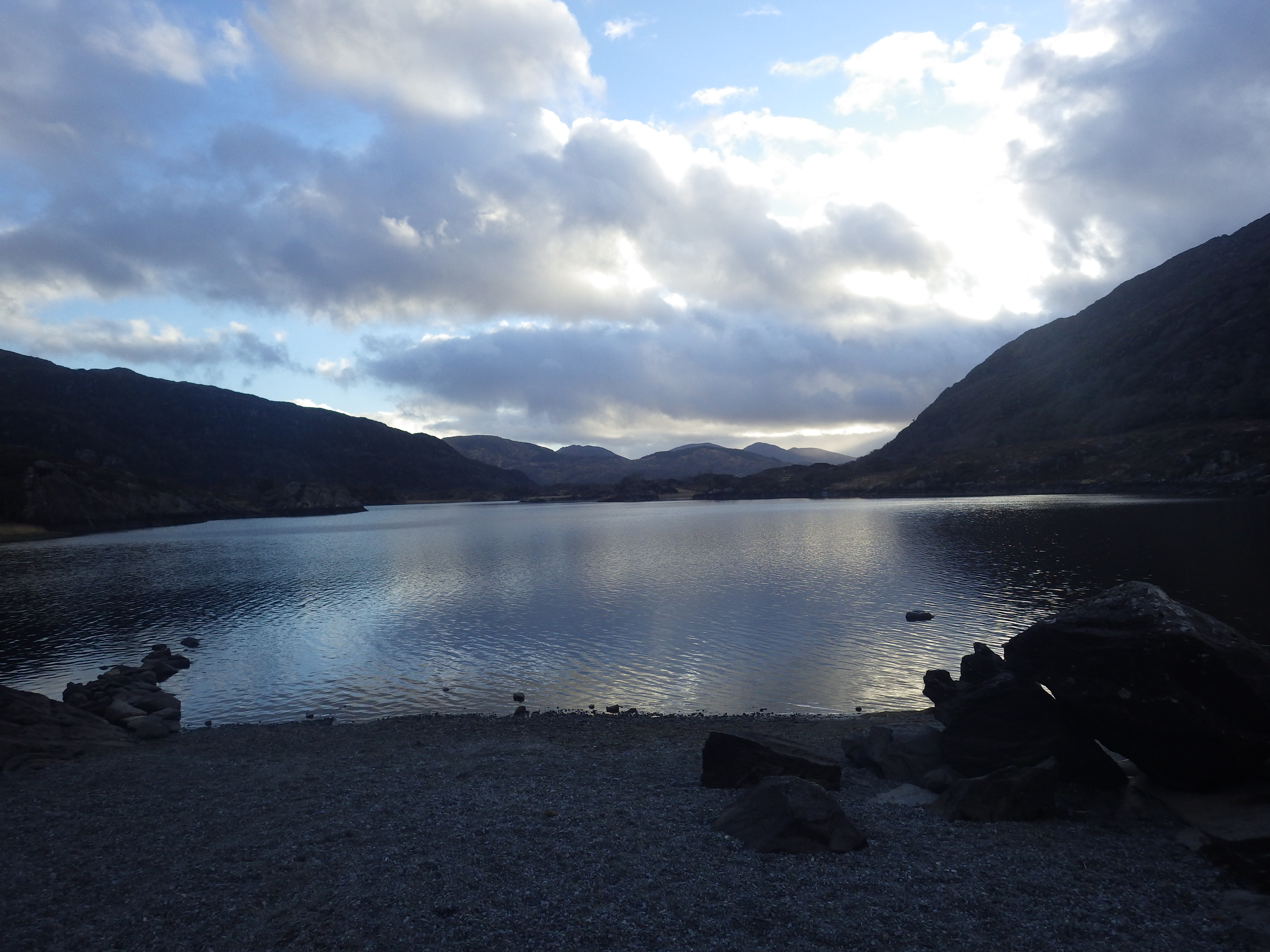

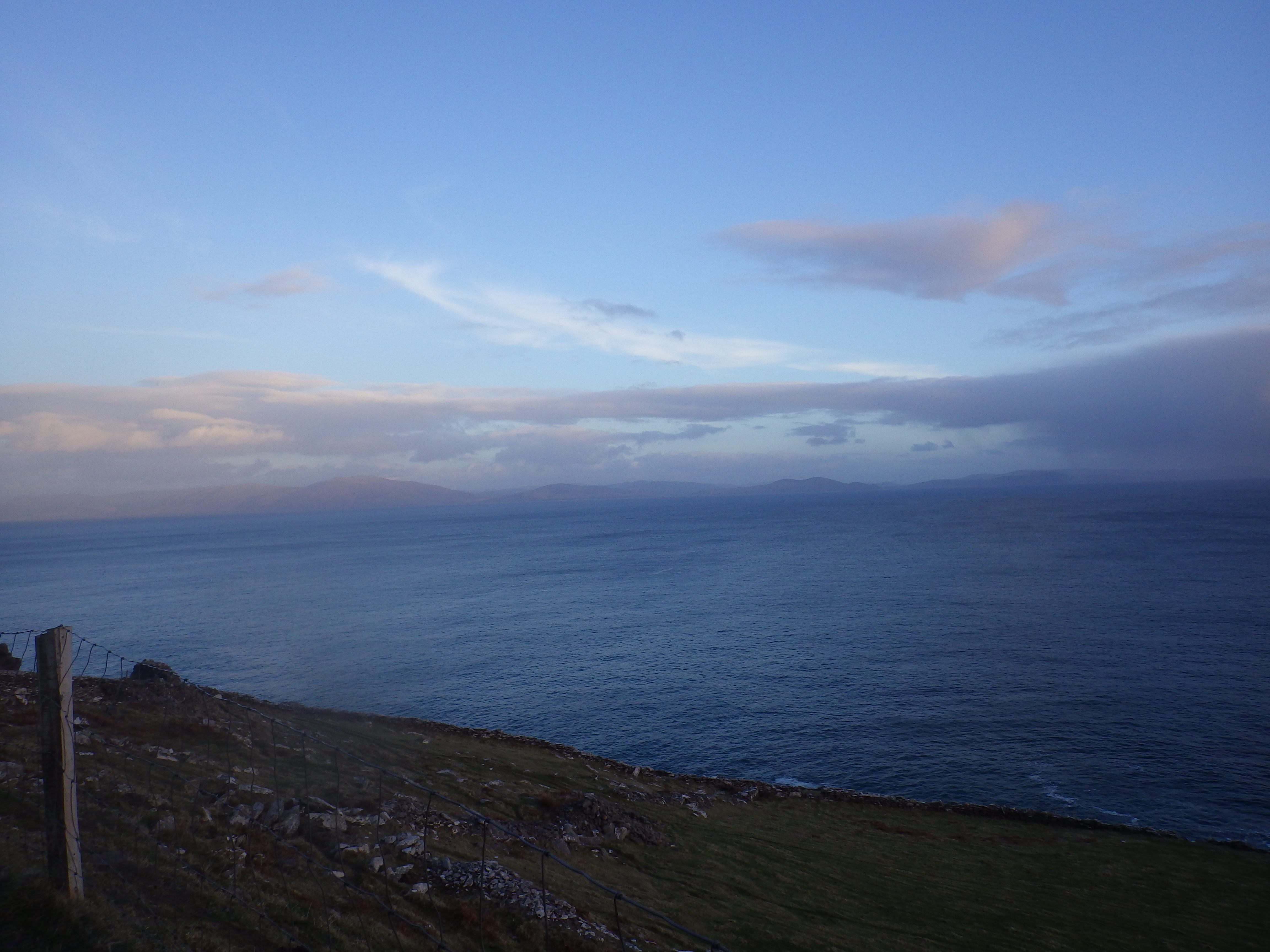
The turn-off for the Black Valley is somewhere near Ladies View, apparently so named for having a view that impressed Queen Victoria’s Ladies in Waiting. We stopped to consult the map and take some photos.


The road goes down from the comparatively unremarkable Moll’s Gap. It’s also got the sort of surface that helps justify buying a road bike that thinks it’s an adventure bike. It doesn’t, apparently, make recent adoptees of sportsbikes happy. Rest stops make for some dramatic photos, though:


The road is a lot longer than I was expecting – 8 miles, and not one to do at speed – and the largely absent mains electricity in the area meant it was quite dark when we arrived. It was also hailing.
We got up the next morning to another hailstorm, but by the time we left it was a lovely day. We elected to go back up to Moll’s Gap the way we came in, partly because that was the only feasible route and partly because we both thought we ought to have a go at enjoying that road.


We stopped at Moll’s Gap when I remembered that motorbikes need petrol to operate, and recalled being warned that petrol stations in rural Ireland can be few and far between (hence the jerry can on my back seat). While I looked for a petrol station, Roni got to discover what a comfortable bike feels like.
After a false-positive we found Derreendarragh (I think that’s spelled correctly, but honestly it’s hard to tell), which was down probably the straightest road for a few hundred miles.


Puzzlingly, it’d dried out for the return journey. We followed the Ring of Kerry to Kenmare (where we’d joined it yesterday) and from there picked up the Wild Atlantic Way, another fantastic signposted route, this one all the way along the Atlantic coast.

At Sneem we came across a layby that basically forced us to stop for a break


Down a few Tracker bars and even more Hob Nobs, we decided on Dingle for lunch and rode on, looking at even more fantastic scenery, some of which we were fairly categorically not allowed in


There is supposed to be a photo of Fungie here, but we didn’t see him. We *did* have some cake, though.

Podcasts topped up (basically every building in Ireland has free Wifi), we headed for the westernmost hostel in Europe.


Behind that tree behind the bikes is the westernmost point on Ireland. In hindsight, we could have parked a bit better.
The next morning we finally got some of the weather I was promised I’d get if I went to Ireland in March


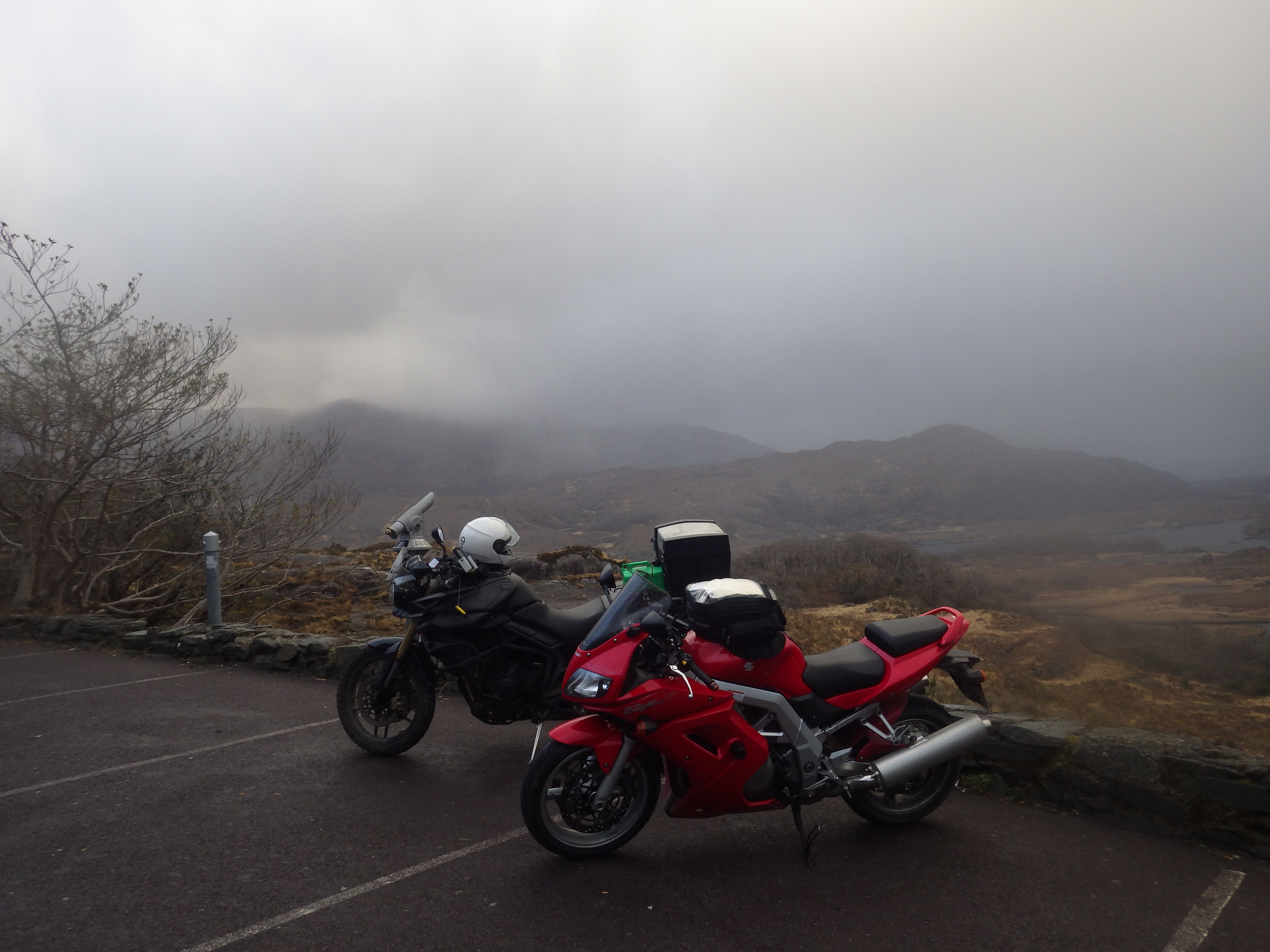
We went back to Dingle, and then out over the Connor Pass. It’s Ireland’s highest pass, and were it not raining and foggy I’m sure we’d have had some glorious views. Were it not so crazy windy Roni might have enjoyed it, too.


Going down the other side was hugely less windy, with odd glimpses of the beautiful countryside under all that fog


This being a day of solid rain, I didn’t take a great deal of photos. We stayed that night in a hotel in Ennis. While we were having breakfast we were accosted by the owner who, as had become something of a theme of our trip, recommended us places to ride.
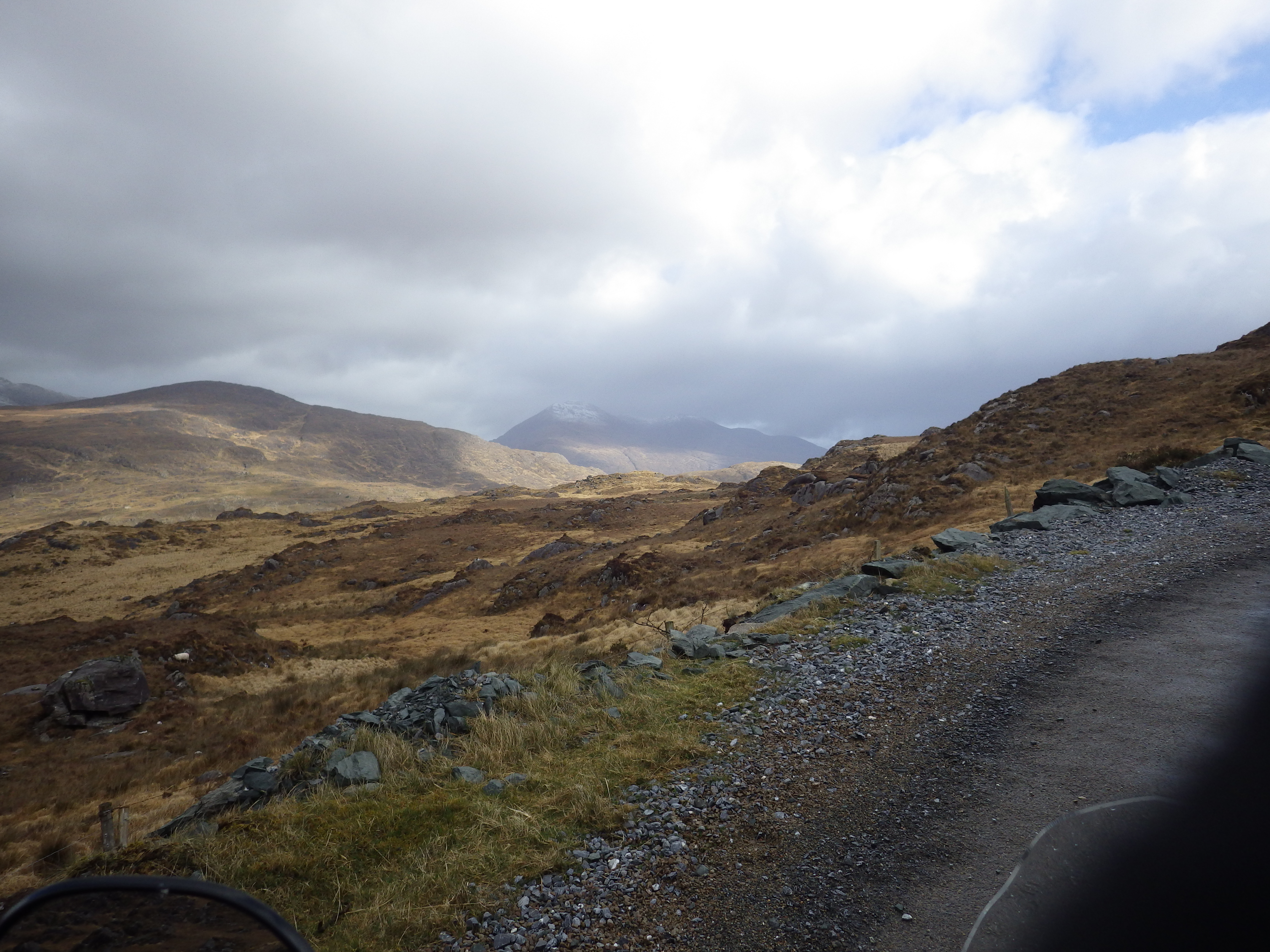
The Wild Atlantic Way is fantastic, but because it hugs coast it takes a long time to get anywhere. Having spent two days now following it quite rigidly, we decided to skip a bit and head for Connemara where we’d pick it up again.
Strapping what gear was still wet to the outside of our bikes and luggage, we set out into more surprisingly glorious sunshine.


Ireland’s chock full of really interesting neolithic bits and bobs, and we’d ridden past loads of it. So we stopped at Poulnabrone Dolmen, a portal tomb, which also featured what Roni continues to maintain was the best half-mile stretch of road of the entire trip, and I’m not sure he’s yet forgiven my turning off it to go and look at a pile of rocks.


That rock formation’s was built before the pyramids at Giza were even planned. It predates basically all unifications, even China‘s. Then it collapsed in 1985 and was rebuilt.
Anyway, we zipped through Galway and into Connemara. Even after all the beautiful countryside we’d spend the past few days in, this was astonishingly pretty.


So much so, in fact, that I didn’t take an awful lot of photos of it.
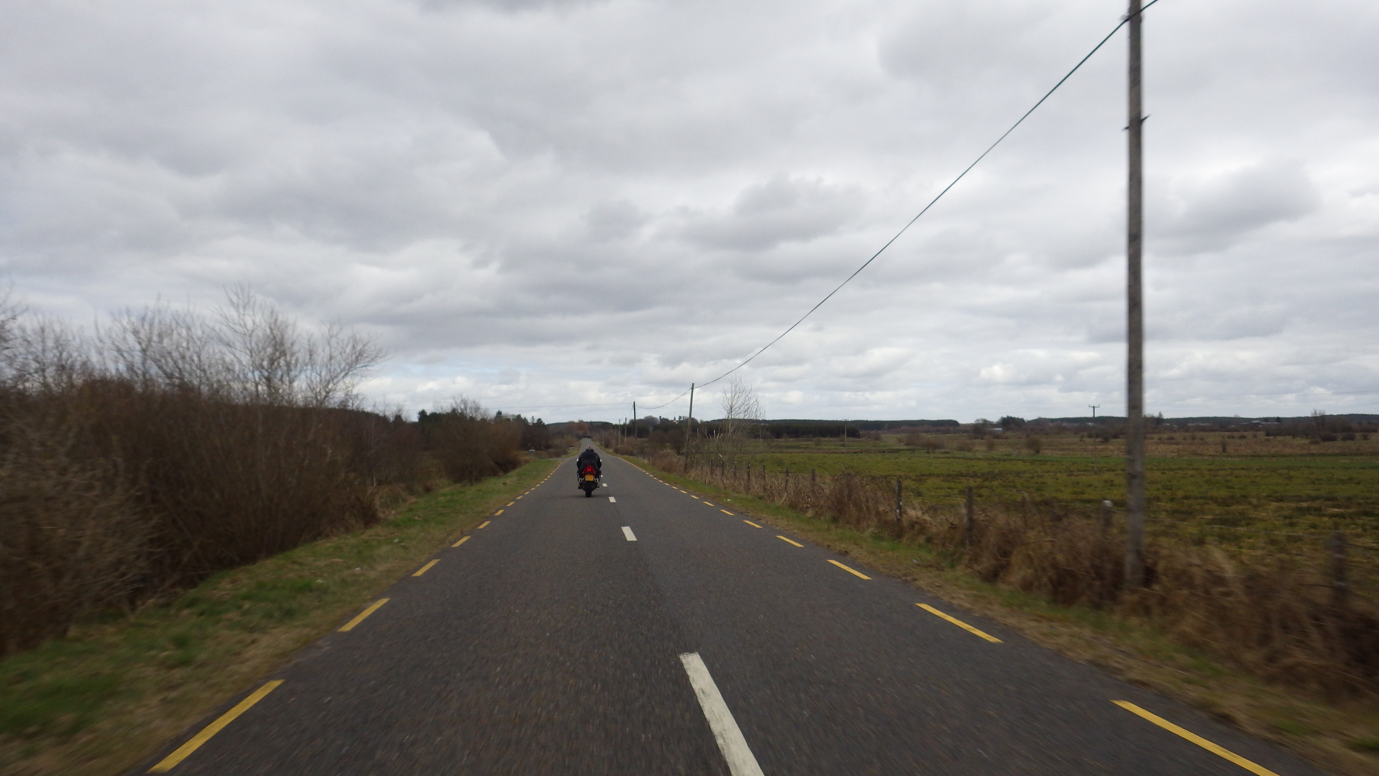
We ended the day in Cong, and spent the next day heading for Dublin. Ireland’s interior is pretty dull compared to the coast, unfortunately, and quite frequently does a rather good impression of the Netherlands:
Impressively, I still spotted the rarest of road users, the Lost Roni:

And, later, the SV finally had something of a problem when the indicators kept not-working. That we’d stopped for me to get some engine oil to feed the Tiger’s cravings, and we then had to push start it to leave, is something I shall gloss over.

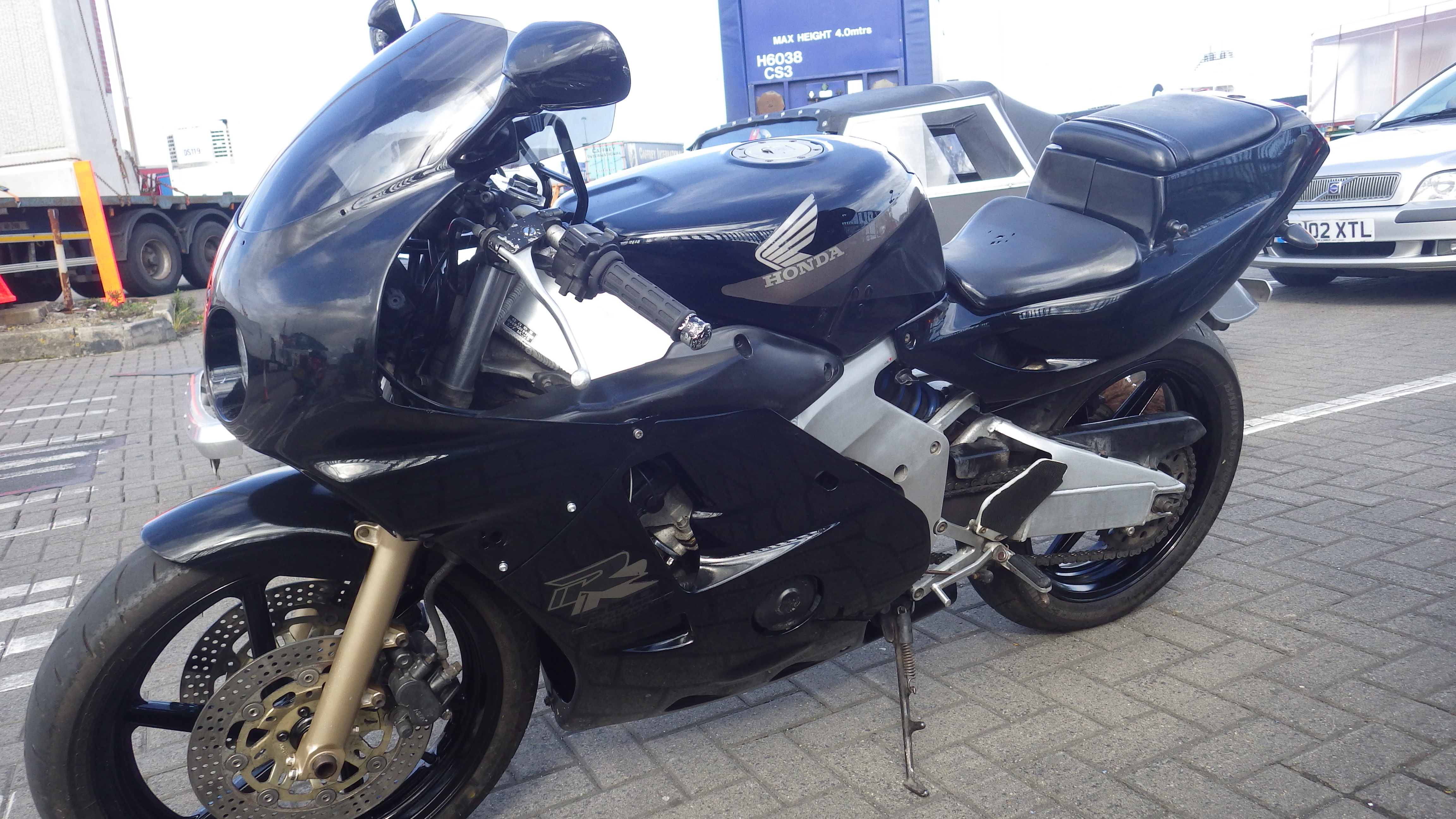
We didn’t really have much time in Dublin, but there was a CBR250 at the ferry:

Back when I started planning this trip I realised that one lovely thing about Ireland is that to get to it you have to go through Wales, and it’s very hard to have a boring time travelling through Wales. Since our last (and, at this point, next) hostel was at Much Wenlock, in England, we were going to have a pretty good go at it.
Coming out of Holyhead on the Roman-straight A5 you can see the fun that is to come on the horizon:

Before all that fun and games, though, I have been near the station with the longest name on the UK rail network many times before, but I’ve never actually got around to going into the town. In keeping with the general trend of British geographical landmarks, it’s a bit of an anti climax:


Here we realised that we were due to get to the hostel about half an hour before it closed, and we’d yet to have any dinner, pick anything up for it or even get any petrol. Time for an uncomfortably quick crossing of Snowdonia!

… and then my camera’s battery died.
Some handy notes:
- The Ring of Kerry and the Wild Atlantic Way are both well signposted and gorgeous. You could spend several days on them without needing to do any other planning. Away from them it’s still tricky to go far wrong.
- WiFi is everywhere – I downloaded a map update in a petrol station.
- Petrol stations could be more abundant in the countryside, but they’re not *that* scarce. They do often close early-evening, though.
- Ride-outs leave on time (or early!)
- An Oige isn’t a coherent unit like the YHA, but more a program which hostels may join. You will find all the hostels on booking.com or similar, and that might be easier than going through An Oige. If you book through An Oige’s site, what you actually do is pay a deposit and cause someone in their office to ring the hostel and book for you.
- There’s little motorcycle parking in Dublin and what there is is quite expensive (NCP style). Considerate parking on the pavement is apparently completely tolerated, and it’s what the locals do.
- If the (Rosslare) ferry’s not particularly busy they don’t turn the kitchen on so you can’t eat on it.
- Speed cameras are craftily hidden. They’re also not DVLA compatible so this is not of real consequence.
- Lots of the roads are poorly (or not-very-recently) surfaced. Apparently punctures are common, but we didn’t have any.
And there’s yet more photos here.